Diverging Diamond Interchange
Oklahoma's second DDI is set to open and a third is being built. I can tell you a little bit about the first.
First, our thoughts are with our friends in Sulphur, Oklahoma, and the other communities affected by the tornados and storms over the weekend. We wish you well and a quick recovery.
Diverging Diamond Interchange
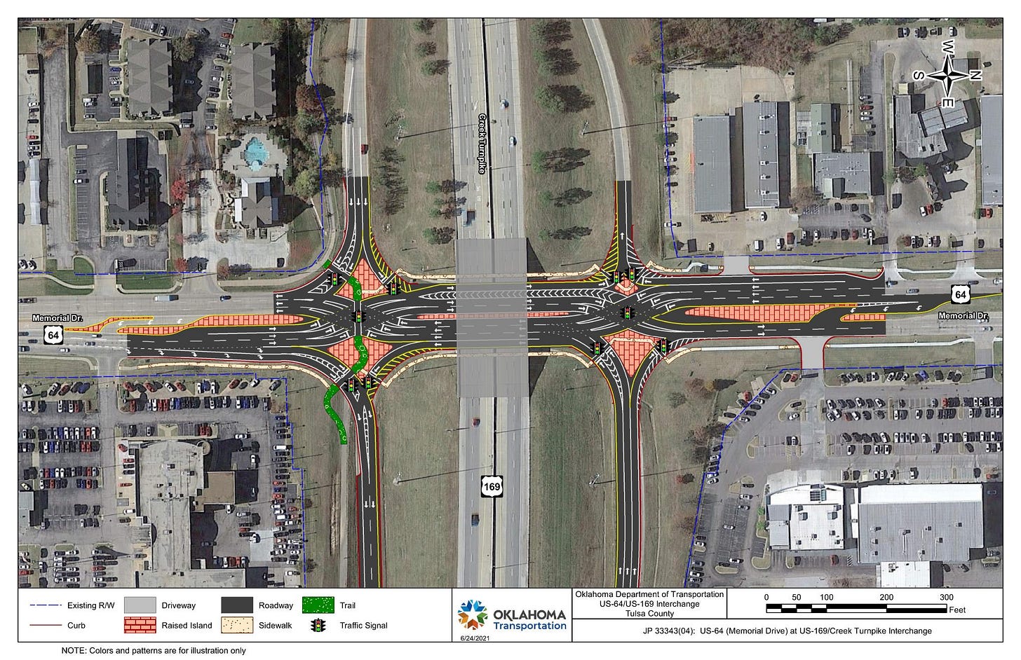
A Diverging Diamond Interchange, or DDI, is a term you probably haven’t heard often. It is just a different form of highway interchange for getting on and off a busy freeway such as an interstate. To oversimplify, it temporarily moves traffic to the opposite side of the road to make it easier and safer to turn left.
DDIs have been in use in Europe since the 1970s and are beginning to appear more here in the United States. The first one was opened in 2009 in Springfield, Missouri.
On Monday, April 29, 2024, Oklahoma's second DDI opened in Tulsa at the US-169/SH-364/Creek Turnpike and US-64/Memorial Dr. interchange. Understandably, if you’re looking at the overhead map of a DDI, it might be confusing.
However, I assure you that once you start using it, you’ll soon not think any more than you would at any other stoplight intersection. How do I know this? I’ve been using one regularly for years.
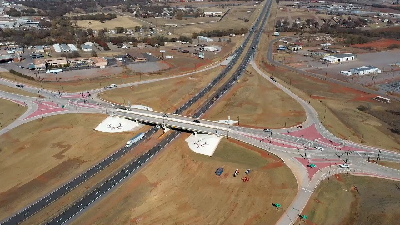
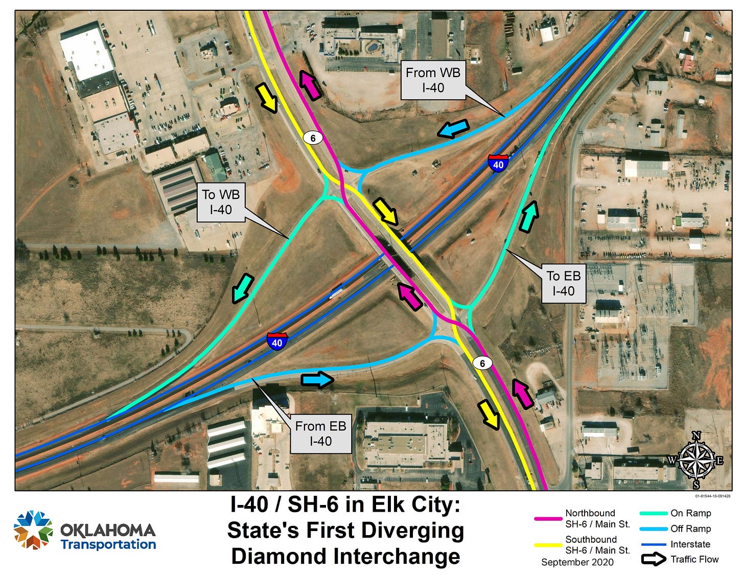
Oklahoma’s first DDI was opened right here in my hometown of Elk City, Oklahoma, at the interchange of I-40 and SH-6 in 2020. It’s on my primary route to and from work, so I’ve become quite familiar with it. I can attest that traffic flow in that area has greatly improved.
One benefit is not having to wait on the many farm, oilfield, and retail trucks turning left off the overpass to enter I-40. That used to back up traffic is something awful. The other benefit is down the road from the DDI. Since traffic is now controlled by stoplights, there isn’t a steady stream of traffic during rush hours. I can exit from work and head home without being stuck for 15 or more minutes.
Yes, there are now two stoplights where there used to be none, which annoyed some people. However, you’re only stopped for one to two minutes, like any other stoplight in town. The only other downside that I’ve found with our DDI is that one of the curves is in direct line with the sunrise at certain times of the year. There's nothing like driving straight into the sun in the morning.
A third DDI is being built near Norman, Oklahoma, at the I-35 and SH-9W interchange. It is scheduled to open in 2026.
If you’re in the Tulsa area, I would love to hear about your experience using the new DDI.
More later. Time to think about other road construction.
In The News
A look at some of the latest headlines from around Oklahoma and beyond.
Deadly tornadoes in Oklahoma leave thousands without power, trail of damage | KGOU
Diverging diamond to open at Creek Turnpike, Memorial Drive | Tulsa World
Turner Turnpike drive between Oklahoma City, Tulsa to go cashless May 1 | KOSU
Oklahoma politics launched with constitutional chaos | Nondoc
Republicans vs. Republicans in Oklahoma | The Journal Record
Last Year’s Teacher Pay Raise Hasn’t Slowed Resignations — Yet | Oklahoma Watch
Oklahoma State Superintendent tells school districts not to comply with new Title IX rules | KFOR
Higher speed limit on H.E. Bailey Turnpike raises concern for guardrail safety | KFOR
New Oklahoma law allows for anonymity on homemade food product labels | KOSU
Which Oklahoma high school football teams are moving classifications? | The Oklahoman
Wildlife study finds more than two dozen black bears living in Oklahoma panhandle | KOKH
About Oklahoma: Haskell County
Welcome to Haskell County.
Haskell County is in the eastern part of the state. It was formed at statehood from Sans Bois County of the Choctaw Nation in Indian Territory. The county was named after Charles N. Haskell, the first Governor of the State of Oklahoma.
Stigler, Oklahoma, is the county seat and the county's largest city. It is located near the center of the county at the intersection of State Highway 6 and State Highway 82.
Other notable communities include Whitefield in the northwestern, Tamaha in the northeastern, Keiota in the eastern, McCurtain in the southeastern, and Kinta in the southwestern parts of the county.
Haskell County shares the Arkansas River, Robert S. Kerr Reservoir, and Sequoyah National Wildlife Refuge with neighboring Sequoyah County.
Established: 1907
County Seat: Stigler, Oklahoma 74462
Nation: Choctaw
Map: Google Maps
Area: 577 mi2 (1,494 km2)
Population: 11,561 (2020 Census)
Time Zone: UTC−6 (Central), DST observed
Area Code: 918
Congressional District: 2
State House District: 15
State Senate District: 7
Weather: NWS Tulsa
Tourism Region: Choctaw Country
History: Oklahoma Historical Society
Historic Places: Exploring Oklahoma History
More Information: Wikipedia
Extras
Here are some more things I hope you'll find interesting.
How The DOOM Soundtrack Changed Metal Forever | The Punk Rock MBA
Film Theory: The Fallout Nukes are a LIE | The Film Theorists
Whatever Happened to STARLOG Magazine? | Dan Monroe / Movies, Music & Monsters
How to Send Self-Destructing Emails in Gmail (Confidential Mode) | Simpletivity
Feedback Welcome
If you have any comments or questions, please don't hesitate to reach out. You can leave a comment on Substrack, email me at blogoklahoma@blogoklahoma.net, or connect with me at Mastodon at @blogoklahoma@social.tulsa.ok.us, Threads at @blogoklahoma@threads.net, or Bluesky at @blogoklahoma.bsky.social.
Also, if you appreciate everything I do at Blog Oklahoma, you can buy me a coffee at ko-fi.com/blogoklahoma. It's not necessary, but it's always appreciated.
Have a great week.
– K.


Interesting! I remember I35 and 9 in Norman. I used to go through there when commuting to OKC. It was a difficult intersection for sure.